Article
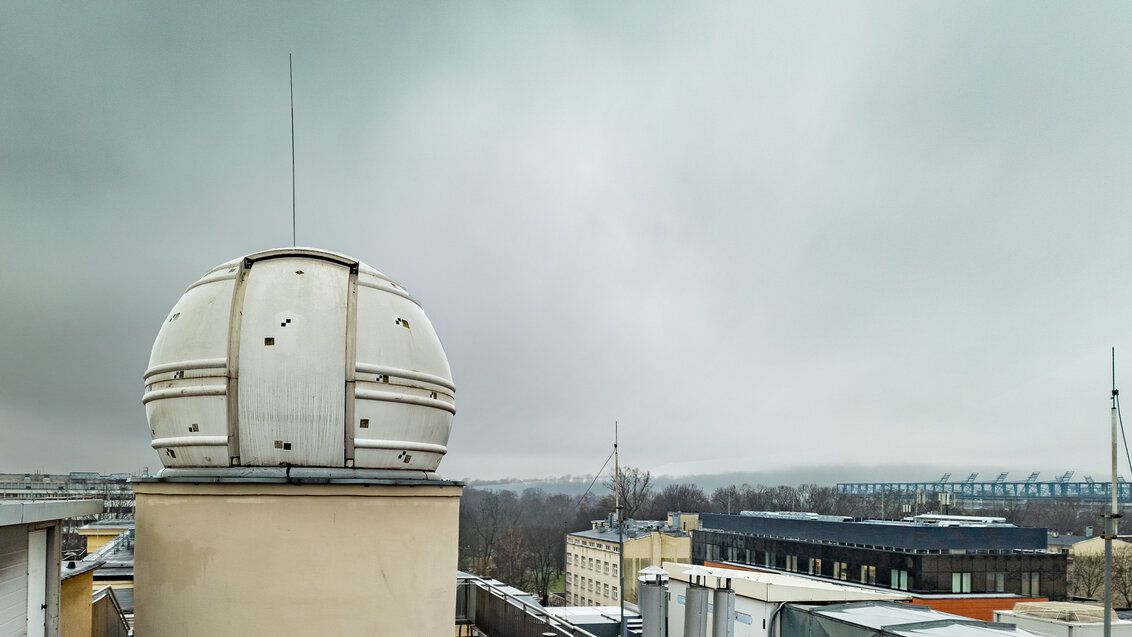
It has been 20 years since the first GNSS satellite signal receiver was launched in an astronomical observatory located on the roof of the Faculty of Geo-Data Science, Geodesy, and Environmental Engineering, which also focuses on astronomical research. In the future, satellite signals will help predict seismic quakes.
On December 26, 2004, a little more than sixty seconds to one according to the coordinated universal time (UTC), the stress between the Burma and the Indian tectonic plates reached critical values, resulting in a fracture that, after only 10 minutes, stretched to span 1,500 kilometres to the north. The earth began to shake. People on the coast of the Indian Ocean still had no idea that a tsunami wave, peaking even at 50 metres, was hurtling at them. Meanwhile, in Krakow, more than 9,000 kilometres away, the measurement equipment kept collecting data on the movement of the Earth’s crust. The first vibrations reached the satellite observatory located on the roof of the Faculty of Geo-Data Science, Geodesy, and Environmental Engineering after only 34 minutes.
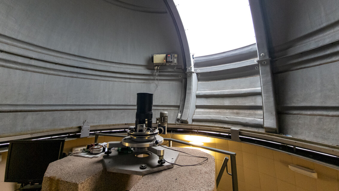
This is where, since 2002, a GPS signal receiver is located, a part of the global satellite navigation system. The second receiver, attuned to the signals of the American GPS and the Russin GLONASS systems, appeared only eight years later. Currently, one of the receivers placed in the observatory receives signals from four navigation systems – in addition to the two mentioned above, the European Galileo and Chinese BeiDou. Each system is made up of several dozen satellites that constantly orbit the Earth and send navigation radio signals. The position of each satellite, as well as the moment of sending the signal, is precisely determined; therefore, knowing the signal speed and the moment of receiving it collected from at least four transmitters, it is possible to pinpoint the location of the receiver. The same principles apply to the navigation apps on our smartphones; the only difference is the accuracy of the measurement.
‘Using a smartphone or car navigation, the accuracy we obtain oscillates between a few metres. When we’re walking through a city and we want to know which street we’re on, this level of accuracy is totally enough. Besides, the navigation applications we normally use have embedded algorithms that determine the position in relation to the street or road, even if we are several metres off. In land surveying, we process the signals that reach us differently, and we can work with them to obtain the accuracy at the level of millimetres. Among other things, we are better at reducing the interference in signals, which occur when they pass through the atmosphere’, says Dr hab. Eng. Jacek Kudrys, Associate Professor at the AGH UST, the supervisor of the observatory.
Constant movement
Precise measurements are the core activity of the observatory. They allow scientists to track the smallest movements of tectonic plates. The Eurasian Plate, where the AGH UST campus is located, travels to the north-east at a speed of 26 millimetres a year. This is less than the Australian Plate (as much as 7 centimetres a year to the north!); but it is important to remember that the implications of such movements must be regarded globally.
The Earth’s crust is flexible to some extent, but the more the tectonic plates interact with each other, the more stress is created between them. When it becomes too strong, it is released and, as a consequence, we get earthquakes. Although individual GNSS measurements are negligible in describing such phenomena, it is due to the monitoring of the movements of adjascent tectonic plates that we are able to measure how much they deform and determine the risk of potential danger. Techniques that use satellite navigation supplement other, physical methods used to predict the moment of sudden change in stress.
‘Night and day, people are investigating the possibilities to develop methods to allow us to predict earthquakes, but no one has managed to achieve this with sufficient precision’, says Prof. Kudrys.
The number of victims lost to natural disasters seems to be high enough to leave no stone unturned globally in dealing with this, so it should come as no surprise that numerous research teams are eager to contribute, even on the smallest scale, to expand the knowledge on these phenomena.
‘Krakow is not located in a zone that suffers from major earthquakes because we are not on the boundary between the tectonic plates; although we do experience quakes in Poland, specifically in mining areas. However, we can observe how the Earth trembles as a result of strong, distant quakes. And we are doing it. For example, when the epicentre of the earthquake is somewhere in Japan, we can observe seismic waves caused by this phenomenon using our GNSS stations’, explains the supervisor of the observatory.
In 2004, when one of the most powerful earthquakes in recorded history occurred, whose epicentre was on the west coast of the Indonesian island of Sumatra, the vibrations of the Earth’s litosphere reached Poland, and the combination of data sets from various satellite receivers allowed us to record the motion of the seismic wave. A similar situation occurred in 2011, when the epicentre was in Japan, and the wave was recorded in Poland by about 100 receivers located throughout the country.
Here meaning where?
Satellite measurements, such as those taken at the observatory of the Faculty of Geo-Data Science, Geodesy, and Environmental Engineering, in addition to long-term benefits, can also be useful here and now. To actually know where this ‘here’ even is!
Already at school we are taught that geographical coordinates comprise two values: longitude and latitude. If we take the spherical model of the Earth, the first value is equal to the angle between the half-plane of the Prime Meridian and the half-plane of the meridian crossing the selected point on the surface of the Earth. To calculate the second value, we need to trace a ray from the centre of the Earth to the point the coordinates of which we want to establish, and then determine the angle between the ray and the equator.
Determining the latitude then requires perfect knowledge of where the Earth’s poles are located, which mark the position of the equator as a plane that is perpendicular to it. The problem is that the location of geographical poles in relation to the Earth’s crust is... constantly changing. Considering that the Earth’s axial tilt moves in relation to the Earth’s crust, the changing locations of the poles results straightforwardly from the definition – as poles are points on the surface of a celestial body with which its axis of rotation intersects. If we want to determine coordinates with high accuracy, we need to know the temporary location of the pole. This is exactly the piece of data that the GNSS satellite measurements provide, measurements taken at the university observatory.
‘The pole travels in relation to the Earth’s surface on a curve called the polhode. It resembles a spiral motion with an intermittently changing amplitude. Its temporary location can be pinpointed on the basis of GNSS measurements, because we can observe the changes in coordinates of points across the entire globe. Satellites move independently of the temporary Earth’s axial tilt, which makes it possible to observe the change in this position’, explains Prof. Kudrys.
One of the measurement points in the observatory, together with other precisely positioned points across the country, create the state geodetic control network. It comprises fixed and stable points throughout Poland, which allows land surveyors performing their work at different times and in distant locations to base it on a unanimous set of coordinates.
Furthermore, the receivers located at the AGH UST belong to the EUREF Permanent Network (EPN) of European reference stations and the European Plate Observing System (EPOS). The data they collect directly contribute to the conservation of the European reference system, which constitutes the basis for creating national coordinate systems.
‘We deliver our observations for the purposes of monitoring the ETRF system and for the state spatial reference system’, the supervisor describes the activities of the observatory.
Additionally, the data also end up in a collection of data analysed by various research teams. Single measurements provide information only on the temporary position, but if we repeat them over time, we obtain quite a valuable image. To make it even more reliable, scientists conduct continuous research related to the quality of the satellite signal and its susceptibility to interference. The receivers at the observatory have been working almost non-stop (taking measurements every 30 seconds) for 20 years, and all the data are stored and shared with all those who are interested in using them.
We also collect and store data from the meteorological station operating on the premises of the observatory, in which scientists measure pressure, humidity, and temperature.
‘Meteorological stations can be useful in processing data because, as we know, the atmosphere has an impact on the propagation of electromagnetic waves and therefore on the distance reading. There are meteorological services in which, in addition to other, our data are used to create models of the troposphere at a given point in time, which are then translated into weather forecasts’, adds Prof. Kudrys.
Every second counts
Carrying out precise measurements is no controversy. Why would it, if, after all, they are what allows us to expand our knowledge about the surrounding world and to get closer to an even fuller understanding of natural mechanisms? However, it is the regulations that are introduced on the basis of these measurements that stir things up. It is surprising, especially when we realise that the bone of contention is a single second. One in a few years!
‘The Earth’s rotation speed, that is, the speed the Earth rotates around its own axis, changes – and this too can be observed on the basis of our measurements’, explains Prof. Kudrys.
For example, the average change in the rotation speed by one millisecond per 24 hours, in one year, results in the change by 365 milliseconds, which gives us about 0.3 second. After three years, we will be at one second and after a longer period still – a few seconds. The implications are that the time measured on the basis of Earth’s rotation, that is, in relation to the Sun or other more distant stars, and the time measured by atomic clocks (based on the resonant frequency of atoms, thus extremely precise but completely unrelated to the planet’s movement) begin to differ.
‘Until now, people believed that these two scales should be synchronous. To achieve this, we’ve introduced the so-called “leap second” – on the same principle that a day is added to a month in the leap year, since the time necessary for Earth to orbit the Sun is not exactly 365 days. The leap second is similar – a single second is added at the end of June or December, so that the difference between the atomic time and the astronomical time is not greater than one second’, explains Prof. Kudrys.
This is the way that the coordinated universal time (UTC) is determined, which we use every day. However, this is about to change soon.
The leap second was not accounted for in computer systems – truth be told, scientists found ways to add it, but their solutions bear significant risks of errors. In the past, similar operations have desynchronised the time between servers and, consequently, led to serious malfunction that took even several hours to fix. No wonder that people in charge of the equipment infrastructure and owners of tech companies (including technological giants such as Meta, Microsoft, Amazon, and Google) were opposed to the creation of the coordinated universal time. Additionally, we might soon have to deal with a situation in which, for the first time, we will have to subtract a second instead of adding it – which, in turn, could bring about even graver problems. A debate sprouted whether the cons of this solution do not outweigh the pros.
In November 2022, during the General Conference on Weights and Measures, a desicion has been made to increase the acceptable difference between UTC and UT1 until 2035 at the latest. As a consequence, it will be possible for the atomic time to be different from the astronomical time by more than 0.9 second. How will those two times be kept in check, so that we can avoid colossal discrepancies over the future centuries? This has not yet been determined.
Photo: Marianna Cielecka
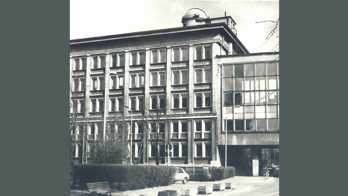
The Faculty of Geo-Data Science, Geodesy, and Environmental Engineering with the observatory dome visible on its roof. Photo from the 1960s: Andrzej Kmieciński. Faculty archive.
 Pre-election meeting with a candidate for the position of rector
  Agreement on cooperation with OPAL-RT
  Krakow DIANA Accelerator consortium members with an agreement
  Meeting with the Consul General of Germany
  More Academic Sports Championships finals with medals for our students
  Launch of AGH University Student Construction Centre
  Bronze for our swimmers at Academic Championships
  Smart mountains. AGH University scholar develops an intelligent mountain rescue aid system