Skip to content Skip to footer
Article

Continents are still growing 

Mapa świata z kontynentami i oceanami

graphic by Dreamstime

Continents are still growing

Geologists see continents as they are – constantly changing rather than enduring over time. The research project led by Dr Katarzyna Walczak from the Faculty of Geology, Geophysics, and Environmental Protection aims to better understand the mechanisms behind their growth.

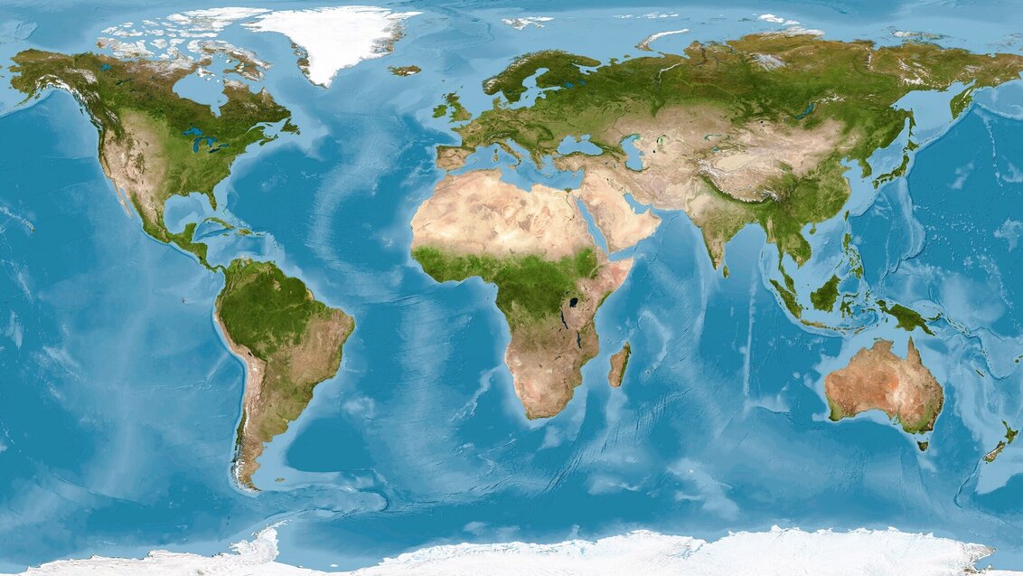
North America, South America, Europe, Asia, Africa, Australia, and Antarctica – when we visualise the Earth, we clearly see the outlines of these seven continents that make our planet unique in the Solar System. At the same time, we are aware that the Earth's crust has not always looked this way. 

Continents are constantly moving and changing their shapes. Once, the lands of present-day North America and Greenland were part of the continent called Laurentia, while northern Europe was part of the continent called Baltica. They were separated by the waters of the Iapetus Ocean. According to scientists, this changed during the Silurian period, a geological period that began about 443 million years ago and lasted for over 20 million years. It was around that time when these two continents collided. Subduction occurred, which is a process that takes place at the boundary of lithospheric plates and involves one plate being forced beneath another. Although this process is very slow, when the stresses become too great, it can lead to a sudden release of energy, resulting in an earthquake. The accumulated rock material from the collision can, in turn, lead to the formation of mountain ranges like the Scandinavian Mountains, which are geological structures whose shapes are still visible in modern-day Europe. 

Ancient islands still await discovery 

Dr Katarzyna Walczak was a member of the team led by Dr Jarosław Majka, associate professor at the AGH University, who conducted research in this area. Finding evidence of subduction in that area was not surprising, as the understanding of the formation of rock chains indicated their presence. However, instead of traces of a single subduction event, scientists found evidence of several successive stages of subduction throughout the entire extent of the Scandinavian Caledonides. 

"We began to wonder why we saw traces of multiple stages everywhere. We came to the conclusion that perhaps the Iapetus Ocean, which separated Baltica and Laurentia at that time, didn't look like the present-day Atlantic Ocean as we imagine it. Maybe it resembled more the area between Australia and Asia? This is where we have numerous volcanic islands and island arcs formed in subduction zones," says Dr Katarzyna Walczak. 

The discovery of both oceanic alkaline rock and acidic rock in these areas may support the theory of the presence of island arcs or microcontinents between the continents. 

To determine the validity of this theory, scientists have decided to conduct more detailed geological research in the regions of the prehistoric Iapetus Ocean. The project entitled "How do continents grow? The Köli Nappe Complex of the Scandinavian Caledonides as a natural laboratory for continental accretion" has received funding from the National Science Centre. Dr Katarzyna Walczak is leading the project, which includes researchers from the Department of Mineralogy, Petrography, and Geochemistry at the Faculty of Geology, Geophysics, and Environmental Protection of the AGH University of Krakow, as well as the Faculty of Earth Sciences and Environmental Management of the University of Wrocław. 

"First and foremost, we would like to determine the environments in which these rocks that were accreted to the Baltica continent formed and the time period during which they formed," says the project leader about its main objectives. "A question that arose from the previous project is how this ocean looked and what processes occurred in it that led to the formation of this new continental crust. We are also interested in the process of the formation of these arcs – whether they were related to subduction or if they were old fragments of continents or microcontinents." 

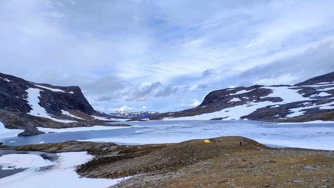
Tent camp on the shores of Lake Láddejávrre. Photo by Katarzyna Walczak

Obóz namiotowy naukowców AGH. W centralnej części jezioro Láddejávrre, nad jeziorem cztery namioty. W tle widać góry częściowo pokryte śniegiem.

Not easy to find, although the search is known 

The Scandinavian Mountains, formed by the collision of Laurentia and Baltica, have a similar origin to the Himalayas and probably once resembled the highest mountains in appearance as well. However, over millions of years, they have eroded and are now much lower. For researchers, this is a significant advantage. 

"Thanks to the fact that this orogen has been eroded, it is as if someone cut through the Himalayas and allowed us to look inside. From a geological point of view, access to these rocks is easy. Moreover, Scandinavia, especially the northern part, has the characteristic of having sparse vegetation, so these rocks are relatively well exposed. We don't have to search for them or dig into them; we can go there, take a sample, and observe the relationships between the different rocks. However, access to the actual areas is often difficult because many of them belong to the Sámi people, the indigenous inhabitants of northern Scandinavia who graze reindeer there and are reluctant to invite outsiders. There are no paths or roads – it's often work in isolation, far in the mountains," explains the researcher. 

Expeditions to gather rock samples must be meticulously planned in advance for several reasons. The area from which samples can be obtained is vast, while the number of samples researchers can collect is limited. The rocks from which samples are taken have a high density, so even a collection of small samples can weigh hundreds of kilograms in total. To optimise their collection and ensure that as many of them as possible are useful in answering the research questions, scientists need to know precisely what and where to look for before heading into the area. 

"We received great assistance from the employees of the Geological Survey of Sweden, who provided us with maps of the area prepared in the 1970s and 1980s, and shared their experiences of working in that region. Before the expedition, we must plan in great detail what and where we will sample, often in places that can only be reached by helicopter or by hiking for several days. We need to take into account food, accommodation, fieldwork, and plan which and how many samples we will collect. Usually, on-site, we need to adjust those plans because what we encounter does not align with the maps, or the maps are too general."   

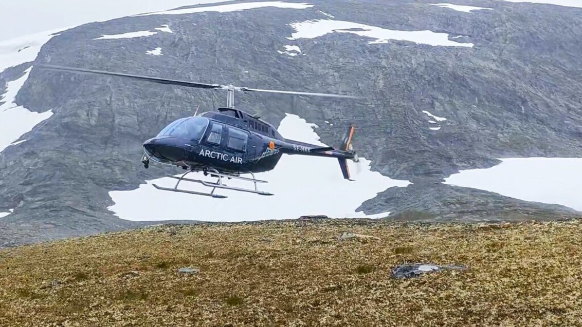
Transport by helicopter to remote research areas. Photo by Katarzyna Walczak

Helikopter z napisem ARCTIC AIR tuż nad powierzchnią ziemi. W tle widać góry z miejscami pokryte śniegiem.

Nothing stays still 

The work of geologists resembles that of detectives – they try to reconstruct the processes based on the traces they discover. Even if they study currently occurring processes, they cannot observe them directly because they happen so slowly and on such a large scale that they are not visible to the naked eye (for example, continents still move a few centimetres each year).   

Due to the research challenges and the complexity of the subject, we cannot be certain about the step-by-step progression of the processes that led to the current appearance of the Earth. However, scientists generally agree that before any continents emerged, the Earth was covered by a nearly uniform ocean of magma, which then cooled and formed the first crust. The beginnings of the present-day continents appeared much later when the process of crustal differentiation began. In this process, acidic rocks started to separate, and having a lower specific weight allowed them to "float" above the denser basaltic crust. That's how the first continents began to form. 

However, this doesn't mean that there are no longer any changes occurring. As suggested by the title of Dr Katarzyna Walczak's research project, continents are still evolving.  

"The 'new' rocks of continents primarily form above subduction zones, where thinner, denser oceanic crust sinks back into the Earth's interior, undergoes melting, and the resulting magma migrates towards the surface, forming igneous rocks. We can observe these processes in volcanic chains called 'island arcs'. Continents expand their size by gradually adding arc rocks to their edges through a process called accretion." 

Although most of the continents are composed of cratons (the most consolidated, oldest fragments of continental crust characterised by high stability), the growth of continents in subduction zones is not a marginal part. It can encompass hundreds of square kilometres of surface area and often includes valuable metal deposits. 

"Australia is moving northward and will eventually collide with Asia. At that point, all the island arcs currently located north of Australia will be incorporated into the continent; they will be pushed onto the continent. Along with them, fragments of oceanic crust and sediment that accumulate on that crust will also be pushed onto the continent. When this happens, the continental crust will not only consist of Asia and Australia, but also the material between them. Similar processes must have occurred at the boundary of Laurentia and Baltica, which is now represented by the Scandinavian Mountains." 

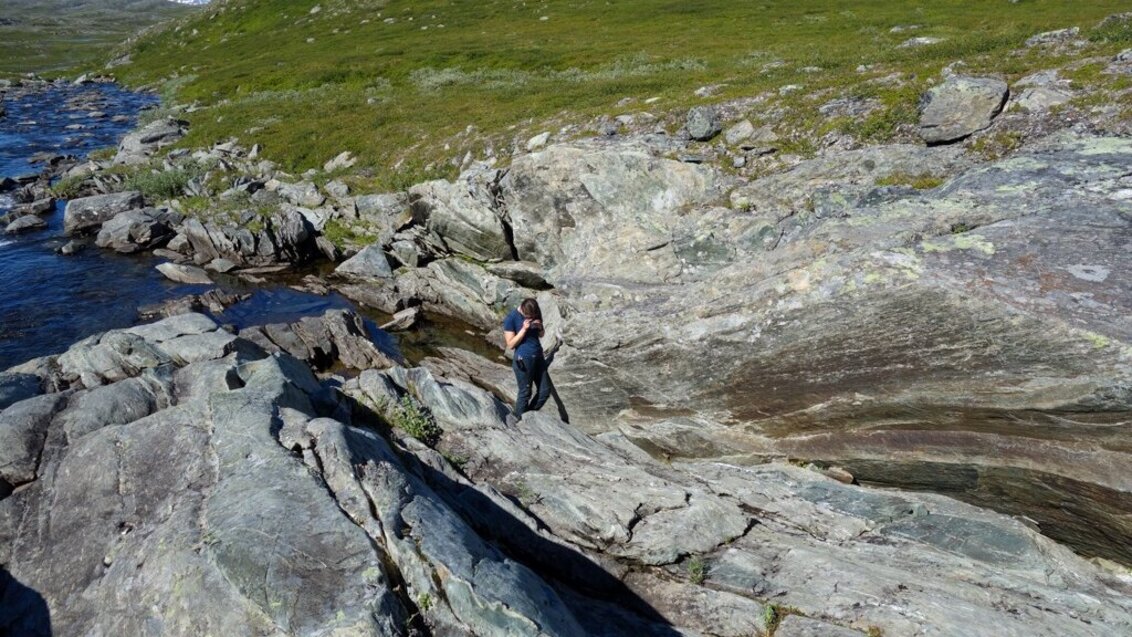
Doctoral student Isabel Carter (AGH University of Krakow, Uppsala University) conducting fieldwork. Photo by Katarzyna Walczak

Doktorantka AGH w trakcie badań terenowych stoi na skałach przy linii brzegu. Z lewej strony widać wodę, w górnej części zdjęcia skały porośnięte są trawą.

Everything leaves a trace 

The methods used in geological research can be divided into two categories. 

The first category is related to geochronology, which aims to determine the timing of geological processes. Radiometric dating methods, used to determine the age of the formation of igneous rocks, have undergone significant development in recent years. With the current level of advancement, scientists will be able to determine the age of individual rock masses attached to continents during the accretion process. These studies involve measuring the uranium-lead isotope ratios in tiny zircon crystals, which enables calculating the age of the mineral's crystallisation from magma. For rocks that do not contain zircon, similar methods can be applied to minerals such as rutile or baddeleyite. Mass spectrometry, which involves introducing a tiny portion of the mineral into the instrument, is used to perform such analyses and determine its isotopic composition. Such a small amount of material is obtained, for example, by means of a laser – a tiny portion of the mineral is evaporated and then sent to the mass spectrometer for measurement. 

The second group of research methods used for increasing knowledge about geological processes aims to infer the tectonic environment in which the processes occurred. 

Geochemical studies are like reading the "fingerprint" of the tectonic environment in igneous rocks. Through these studies, researchers can infer the environment in which the studied rocks formed. 

Some of the rock samples collected during fieldwork will be crushed, ground, and homogenised to contain elements from the entire rock. Both chemical and isotopic analyses will be performed on samples prepared in this way. 

"This will allow us to answer questions about the formation of specific rocks. The amounts of individual elements building the rock, especially trace elements present in very low concentrations, serve as indicators of the tectonic environment in which the rock formed. It will help us to answer questions about the sources of the magma from which they formed, whether their formation was associated with continental collision, or whether their origin is related to continental or oceanic environments. Geochemical studies will be complemented by lead and neodymium isotope analyses in the same rocks. Additionally, hafnium and oxygen isotope studies will be conducted on zircons," explains Dr Katarzyna Walczak. 

Zircon crystals are highly resistant minerals, so they often go through various stages. They typically crystallise from magma, then "survive” erosion of those rocks, get deposited in sediments, and the sediments can later undergo metamorphism, melting, or metamorphism followed by melting. Zircons can thus record multiple geological events. For example, magma may form within continents where such minerals are "produced", then zircon can be transported along with eroded material into the ocean, where it combines with other minerals to form sediment. It is then "absorbed" by the subduction zone where, through the melting of materials, magma is generated again. By studying the chemical composition and isotopic signatures of hafnium and oxygen in zircon, we can infer the conditions in which a particular portion of zircon formed. This allows us to make inferences about the events and the path that these minerals have undergone.   

This is possible because isotopes of different elements have preference for some specific environments more than the others. For instance, oxygen isotopes differ in weight, and water enriched with lighter oxygen isotopes will evaporate more readily than water enriched with heavier isotopes. Therefore, heavier oxygen isotopes are expected to be associated more with seawater, while lighter isotopes are more associated with precipitation, indicating a more continental environment. 

"Geochemical studies of rocks attached to Baltica were mainly conducted almost 40 years ago, and there have been relatively few advanced, modern geochemical and isotopic studies that could provide more detailed information about the sources of igneous rocks and the processes involved in their formation. Hence, our planned systematic application of these methods aims to determine the timing and environment of the formation of the Iapetus terranes, as well as their evolution and accretion. We hope that employing a modern approach to this problem will allow us to obtain a much more comprehensive picture of the tectonic processes leading to the formation and growth of the new continental crust," summarises the scientist from the AGH University. 

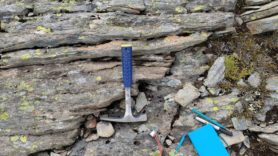
Equipment necessary for fieldwork. Photo by Katarzyna Walczak

Na skalistym podłożu leży sprzęt do pracy w terenie, min. młotek, ołówki, notes.

Stopka