News
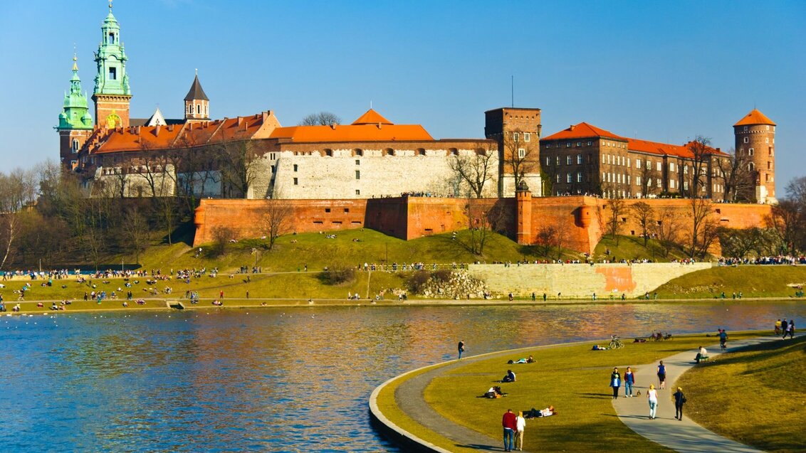
Created by students and staff from the Faculty of Geo-Data Science, Geodesy, and Environmental Engineering, a detailed geodetic control network for the Wawel Royal Castle will be used for surveying, conservation, archaeological, and educational work.
A survey report containing the results of the measurements performed was accepted into the National Geodetic and Cartographic Resource (PZGiK) on 28 November 2025. On 18 March 2026, it was formally presented to the Castle and Cathedral authorities. The work involved in creating the horizontal and vertical control surveys for Wawel, as well as the horizontal control survey for the castle interiors, took over three years.
Foundations for all measurements
A geodetic control network is a network of points with known coordinates that serve as reference points for surveying operations. The national network consists of primary and detailed control networks, such as those established at Wawel. The latter are characterised by a denser distribution across the area than the former, which makes them useful for local operations.
In the case of a horizontal control network, the position of points is described by coordinates X and Y expressed in metres, which specify their location relative to the origin of the coordinate system. In Poland, that is PL-ETRF2000, which aligns with the European Terrestrial Reference System 1989 (ETRS89), the EU-recommended frame of reference for geodata.
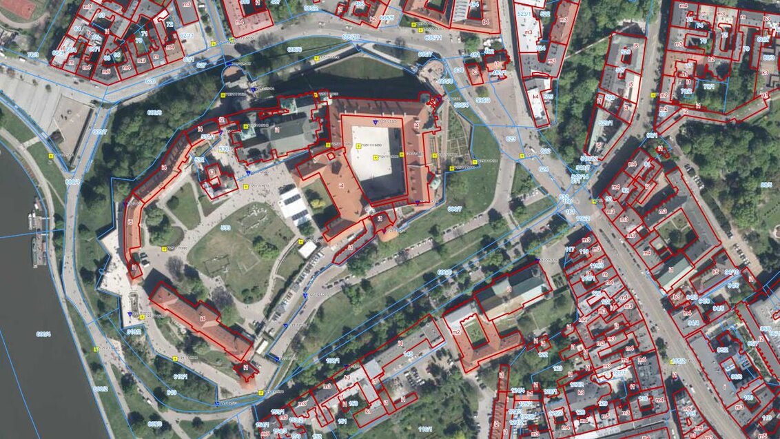
Satellite image of Wawel showing the locations of geodetic control points. Source: Geoportal.gov.pl
The elevation of vertical control points is expressed in metres above sea level, with the ‘0’ level adopted in Poland based on the European Vertical Reference Frame, i.e. PL-EVRF2007-NH. The system is based on the Amsterdam Ordnance Datum, or Normaal Amsterdams Peil (NAP).
Horizontal control points are marked in the field using various types of permanent markers, whilst vertical control points are usually marked on building walls using benchmarks.
Surveying begins with locating such points and reviewing the existing documentation. Then a detailed local control network is established for the duration of the works. It is linked to higher-order, primary geodetic control network. This hierarchical structure provides a consistent reference framework that enables surveyors to determine and describe the positions of plots of land and features within a common geodetic coordinate reference system.
Wawel without a control network
The idea to establish a new geodetic control network at Wawel came about by chance. Dr Anna Przewięźlikowska from the Faculty of Geo-Data Science, Geodesy, and Environmental Engineering, who later supervised the project on behalf of the university, approached Mariusz Meus, an employee of the Wawel Royal Castle, a surveyor and science communicator, whilst searching for interesting topics for students’ diploma theses.
“He pointed out that there are very few geodetic control points within Wawel and its immediate surroundings. He thought it would be worthwhile to create such a network,” reports the AGH University researcher.
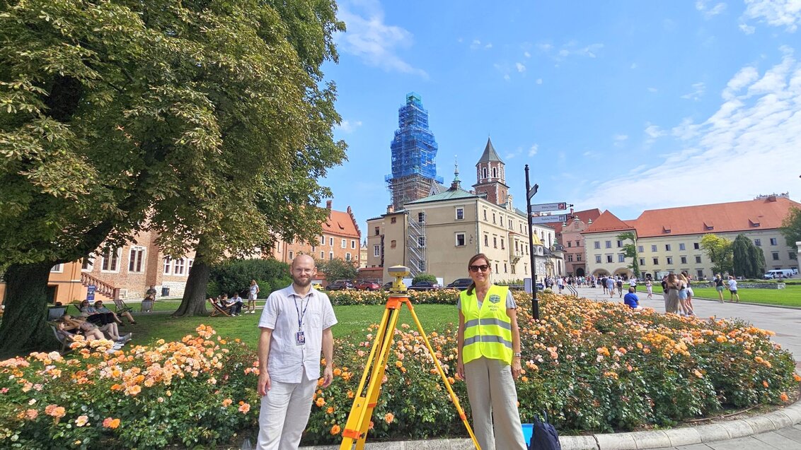
Mariusz Meus and Dr Anna Przewięźlikowska, Photograph: Team archive
The first survey work on Wawel Hill was carried out in the second half of the 19th century by Austrian surveyors. Further projects began at the dawn of the new century, when the first steps were taken to restore the Royal Castle, which was in a state of near ruin after many years of turmoil and military occupation.
In modern times, a detailed horizontal control network was established at Wawel in 1953–54 by Professor Jerzy Gomoliszewski. However, when Dr Przewięźlikowska, together with a group of students, consulted the archival records and attempted to locate the survey points he had established, it turned out that they had already been destroyed.
Nevertheless, the team discovered several dozen old benchmarks, some of which are of historical significance, as well as markers within the Royal Castle stabilised by engineer Jan Banaś in 1974. Both were re-measured during subsequent work and, where possible, have been incorporated into the current network.
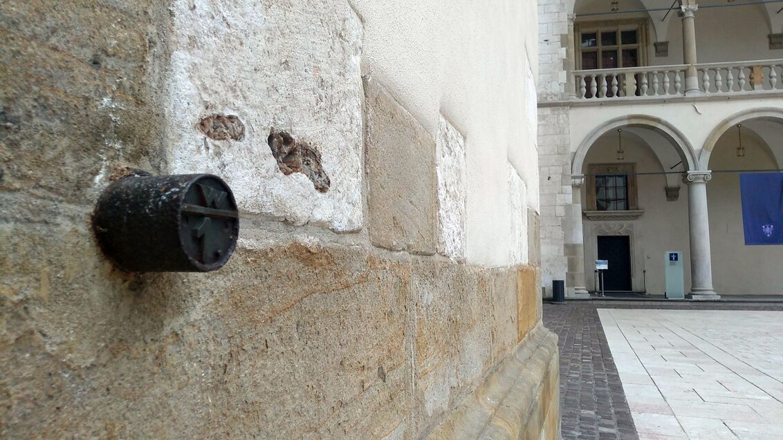
One of the benchmarks located at Wawel. Photograph: Team archive
Lengthy administration procedure
After a detailed analysis of the problem, Dr Przewięźlikowska and Mariusz Meus were able to set the next steps in motion. They convinced the management of the Royal Castle that the establishment of a new geodetic control network on the Wawel site would be beneficial to the historic buildings. They argued that the network could be used during surveys for future conservation, archaeological, and geological work, as well as for educational purposes.
The next step was to submit the plans to the surveying department of the City of Krakow, responsible for overseeing survey work carried out within the metropolitan area.
“From the outset, we aimed for this to be a fully-fledged report, rather than merely a project carried out for the purposes of a diploma thesis. We submitted it to local geodetic and cartographic authorities and carried out the work in accordance with all the principles of surveying, up to the submission of the complete survey report,” the academic emphasises. “Special thanks are due to the city council staff who supported us along the way, so that the results of our work would be incorporated into the National Geodetic and Cartographic Resource."
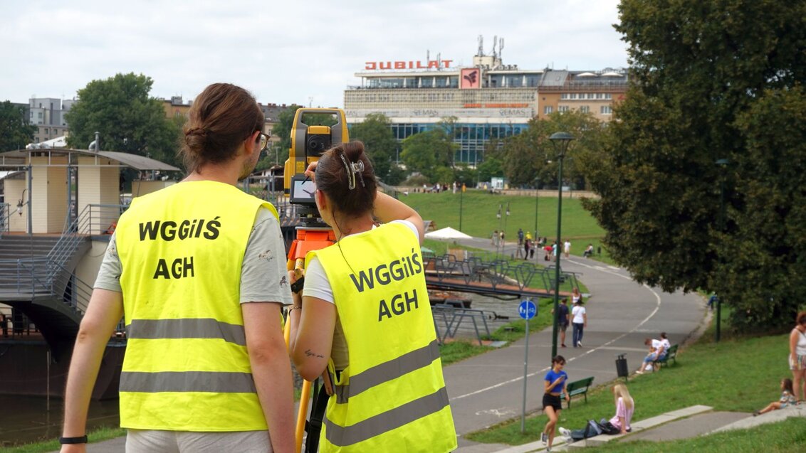
Control network measurements near Wawel. Photograph: Team archive
As explained by the AGH University scholar, the establishment of detailed networks is not a typical task for students at the faculty.
“Special qualifications are required to perform such work, and within our faculty, these are held by Dr Tadeusz Szczutko, Associate Professor at AGH University. He also provided us with considerable assistance during this project.”
All works must also have been approved by the local conservation officer.
Greenlighted field work
In addition to the six students supervised by Dr Przewięźlikowska, the actual work on the Wawel site was carried out by a large group of students from the Faculty of Geo-Data Science, Geodesy, and Environmental Engineering at AGH University.
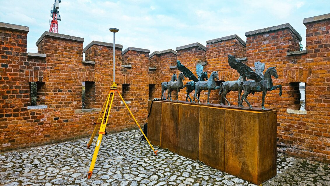
The first stage of the work involved the establishment of a horizontal control network with 20 points stabilised and surveyed on the hill and in its immediate vicinity. Many of these measurements were performed using the static method with high-precision Global Navigation Satellite System receivers. When satellite communication was hindered by an obscured horizon, the students relied on angular and linear measurements.
A GNSS receiver during measurements. Photograph: Team archive
The next stage of the fieldwork involved the stabilisation and measurement of vertical control points using a high-precision levelling method, followed by control surveying within the buildings using the so-called three-tripod method.
As part of the project, the students also made use of drones, employing photogrammetry and laser scanning techniques to generate a point cloud of Wawel, which can then be used to create digital terrain models or 3D visualisations.
A castle that challenges surveyors
Dr Przewięźlikowska emphasises that for her students, the surveying work carried out at the castle became a true “school of surveying”, as it not only required the coordination of teams of around ten people working simultaneously each day, but also involved addressing unusual technical challenges.
“We carried out measurements in a very narrow and steep passageway leading from the arcaded courtyard to the Royal Gardens, which exceeded the capabilities of standard equipment. Thus, we decided to use low mining tripods provided to us by our faculty colleagues. We also encountered difficulties with satellite measurements: the castle’s tall, closely spaced walls obstructed the view of the horizon, so we had to use extensions which were over a metre long to raise the GNSS antennas,” reports the AGH University researcher. “Also, we had to aim through narrow openings in the Wawel walls at points much further down Grodzka Street, which we had to take into account before planning where to stabilise the network. Levelling measurements also yielded quite a few surprises. Due to significant differences in height, the standard two-metre levelling rods were often too short, so we used both rods over three metres long and very short one-metre rods. When placed on the benchmarks, they proved to be better suited to uneven surfaces of the walls.”

Measurements inside the Wawel Royal Castle. Photograph: Team archive
Surveying and Vistula’s water level
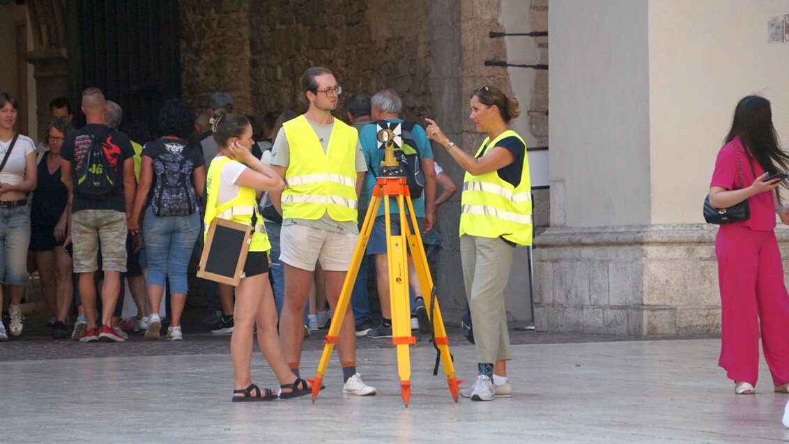
The works were scheduled to take place outside of tourist rush hours wherever possible, but most of them still coincided with the busiest periods. Despite assistance from Castle Security, who at times tried to cordon off the site, it was not possible to completely avoid contact with visitors to Wawel. This has led to a number of humorous situations.
“While working, we were wearing the faculty high-visibility vests, which is why many people mistook us for Wawel staff. The students, and sometimes I too, were asked practically every day for directions on where to go and what way to turn,” explains the researcher. “Once, we were carrying out vertical measurements when a flood warning was in force. Of the three days set aside for the work, it rained continuously for two of them. The students took measurements as they walked from Wawel along the Vistula embankments using three-metre measuring rods. Passers-by stopped to ask whether the river would reach this height.”
Geodetic measurements at Wawel Hill. Photograph: Team archive
Geodesy on the rise
The project’s outcomes go far beyond the Wawel surveying network itself, which will be available for professional use during their surveys. From the outset, one of the project’s aims has also been to spark an interest in surveying among people who do not deal with it professionally.
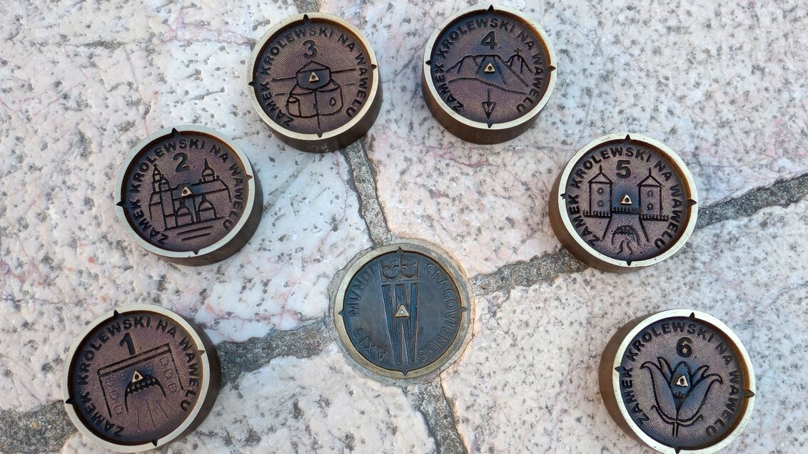
Decorative benchmarks used for control points at Wawel. Photograph: Team archive
On the initiative of Mariusz Meus, seven points of the detailed horizontal network have been anchored in the landscape in the form of benchmarks designed by him, adorned with images associated with the locations where they are situated. These include a marker depicting the meridian of Giewont, which runs through both the famous Tatra peak and Wawel Hill.
Using the point cloud generated during the survey, a virtual 3D model of the castle and its immediate surroundings was also created.
Awarded theses
With the initial catalyst for the initiative being the search for research topics, the project culminated in three diploma theses. Their authors focused on creating control networks for the Wawel Royal Castle; these were Aleksandra Lis and Karolina Wolska, Justyna Piekarz and Marcelina Piegza, and Magdalena Piwowarczyk and Klaudia Sitek.
The first duo took first place for the best engineering thesis in a competition organised by the Association of Polish Surveyors, while the next two students were recognised in an AGH University competition.
“The time spent on the development of theses went well beyond the standard time frame. This required a great deal of commitment from the authors; they also had to encourage their fellow students to get involved in voluntary work. You could say that for everyone involved this was the project of a lifetime rather than a typical surveying job,” concludes Dr Przewięźlikowska.
 AGH Solar Plane comes fifth in SUAS 2026
  The future of technical universities and quality of education in focus at AGH University
  Academia and industry unite for AI: establishment of CESAR
  AGH University in 2026 Global Ranking of Academic Subjects
  Polish Press Agency launches Scientific Think Tank with AGH University
  Can tree pests yield biopolymers? AGH University researcher seeks sustainable solution

