Article
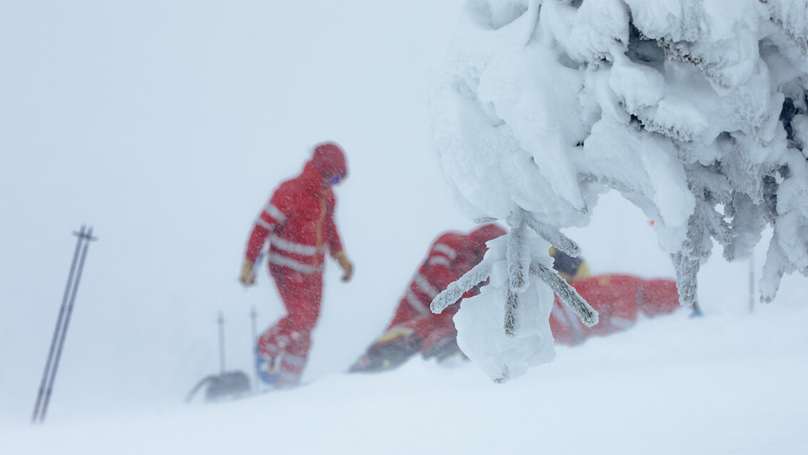
Photo source: Dreamstime
Although a common motive for trips to the mountains is an escape from the civilisation, nowadays they are only little less saturated with electronics than large metropolises. In addition, we are the ones that bring it to the picture. Dr Radosław Klimek, AGH University associate professor, took advantage of the fact when developing a computer system monitoring the safety of tourists. By using localisation data, the application can alarm rescuers about someone lost on the trail or being there during a weather breakdown. It may accelerate the decision on sending a rescue team in situations when getting help on time is of the essence.
Three tourists go on a hike in the mountains in winter. At first, they all move steadily, however, after a few hours of walking, one of them is getting weaker and is falling behind. The fog limits the visibility to only a few metres so the rest of the group do not have eye contact with each other and do not notice that their companion is exhausted. A freezing wind begins to blow, the snow is falling covering the traces. The tourist left behind steps off the path and loses sense of direction. The remaining two finally take notice their friend is missing and start looking for them. Shortly, they also get lost in the snowy blizzard. It is getting dark and no one in the group is prepared to camp in the mountains. They all face death from hypothermia, however, the electronic system monitoring the tourist traffic has already alarmed the rescue team that the group has found themselves in a difficult weather conditions and one the people went off the trail. The duty officer begins to closely observe the points symbolising the location of tourists on the monitor. When they realise that the group is stuck, the decision is made to send a snowmobile patrol. Rescuers manage to quickly find the unlucky tourists and drive them safely to the nearest shelter.
This is what a real rescue mission could look like in mountainous areas where it would be possible to implement the system designed and developed with the participation of students by Dr Radosław Klimek, professor at the Faculty of Electrical Engineering, Automatics, Computer Science, and Biomedical Engineering. Its prototype version was recently described by him in an article on the pages of the prestigious Information Sciences journal. The software can make real-time assessments of a given hiker's vulnerability at a given location, depending on weather conditions recorded by the nearest weather station, the time of day, or the trail’s level of difficulty. It can use both GPS devices provided by tourists and the network of base telephone stations (BTS) to determine the location of people in the field. It also handles information sent by tracking collars worn by wild animals, making it possible, for example, to prevent human encounters with large predators. The configurable environment allows you to enter data on the specifics of a given area or define situations when the system should generate a threat alert. The whole system is complemented by a visual module that allows you to follow the situational picture superimposed on the map displayed on the monitor.
When help arrives too late
“It all started from media coverage on Babia Góra. I was astounded to hear that each year at least a few tourist die there even though it is not an alpine-type of a mountain. These dangerous situations occur once the weather conditions get worse. Based on the information from the rescuers working there, plenty of such tragic events could have been prevented if they had received a message that someone had went off the trail. At the time, there was an idea that it would be good to have a system that monitors the behaviour of people in the mountain area and assesses the situation for potential threats in real time. The idea is that the rescuers on duty, observing the situation on the monitor, will be able to send support to the site if necessary,” Professor Radosław Klimek describes the motivation behind the system.
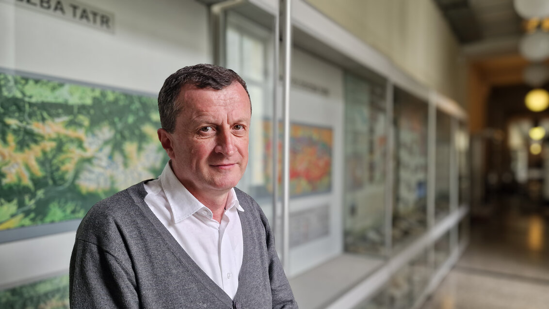
Dr Radosław Klimek, AGH University associate professor; Photo by Marianna Cielecka
The correctness and accuracy of the app was tested during computer simulations that corresponded to daily monitoring of the Babia Góra National Park area. The test scenarios took into account different seasons, and weather conditions, as well as tourist traffic typical of the simulated period. While handling all possible data streams (GPS, BTS, telemetry collars, meteorological station readings, etc.), the application ran efficiently on a standard computer while monitoring 3,000 tourists, which significantly exceeds the peaks recorded by the Babia Góra Park during the summer season. What is more, load tests conducted later showed that it is also able to operate efficiently with more than twice as many tourists. Where it could actually be successfully implemented, it could not only help increase the safety of people in the mountains, but also provide valuable data on their behaviour that would allow area hosts to manage tourist traffic more effectively. To Professor Radosław Klimek's knowledge, the application he designed is the first of its kind in the world, developed with the mountain environment in mind.
Systems notice context in data
The solution developed at the AGH University is in the category of so-called context-aware services, i.e. IT solutions capable of deriving data about the user and his environment from various types of sensors and adjusting its operation depending on the coincidence between the data. No information is treated as an autonomous entity in such a case, but occurs in a specific context given by the remaining information. An example of such solutions are, for example, popular car navigation applications, which, based on the user's location, are not only able to indicate the shortest route and time to reach a destination, but also adjust the route on an ongoing basis depending on continuously updated information on road obstructions. In a growing number of cities, smart city solutions are implemented to make it easier to get around by public transportation. Using the user's location and location data sent by buses or streetcars, they are able to give real-time information on delays and indicate convenient changeovers. Smart solutions are also being used to manage traffic signals or street lighting.
“If we already have smart cities, why can’t we have a smart mountain environment? Although it is easier to implement such solutions in cities due to the high saturation of their area with various sensors, but mountain areas are also a great fit for this purpose. Meanwhile, as far as I know, our system is the first one developed for this environment, and nowhere in the world similar solutions are in operation so far,” declares the AGH University researcher.
American visionary and proliferation of computing machines
Although systems that use communicating devices to deliver various types of services have only been around for a dozen years or so, the idea itself has a somewhat longer history.
Professor Radosław Klimek references the figure of an American professor, Mark Weiser: “This computer science visionary, who worked at the prestigious Palo Alto Research Center in California, wrote in an article in Scientific American as early as the 1990s on deep technologies that permeate everyday life to the point where people stop noticing them. Weiser claimed that also in the case of computer science the goal is to reach a point when computers will perform various calculations without us even being aware of it happening. He introduced the concept of ubiquitous computing; pervasive computing is more commonly used in this context today, and it is supposed to make our lives more comfortable and secure. It should be noted that he wrote this at a time when computers stood primarily on desks. Since then, many things have had to happen for the idea to become a reality."
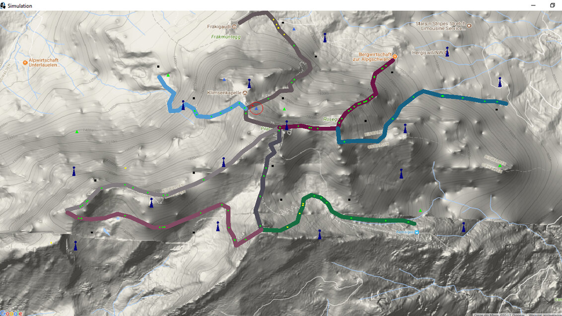
The visual module of the application allows to follow the situational image superimposed on the map displayed on the monitor; Image provided by Professor Radoslaw Klimek
“In this context, the so-called computational waves are also worth paying attention to,” says the AGH University scientist. "During the first wave, we had many users per computer – people had to compete for access, just as it is today with supercomputers that perform superfast calculations. During the next wave, everyone already had a personal computer, and during the last wave, we already have multiple computers per person – PCs, smartphones, and various other devices. All of these devices can connect with each other. Again, there have been very significant advances, not only in the communication technologies themselves but also in transmission protocols. Although we use devices from different manufacturers on a daily basis, information between them may be exchanged quite easily. All of this means that the vision presented by Mark Weiser in the 1990s is not only coming to life, but is also changing the way we think about programming. We used to assume in advance how input data should be sorted, whereas now it is up to systems to be aware of the context and perform calculations on this basis."
In addition to the described mountain rescue aid system, Professor Radoslaw Klimek is also an author of other works devoted to solutions for smart cities, concerning, among other things, the management of tourist traffic and street lighting.
 Pre-election meeting with a candidate for the position of rector
  Agreement on cooperation with OPAL-RT
  Krakow DIANA Accelerator consortium members with an agreement
  Meeting with the Consul General of Germany
  More Academic Sports Championships finals with medals for our students
  Launch of AGH University Student Construction Centre
  Bronze for our swimmers at Academic Championships
  Smart mountains. AGH University scholar develops an intelligent mountain rescue aid system