Skip to content Skip to footer
Article

AGH UST scientists want to use satellite data to warn about sinkholes

The picture shows a satellite orbiting the Earth. It emits a cone-shaped radar wave towards the planet, marked symbolically in green. The wave leaves a trail of topographical image of the scanned fragment of the Earth.

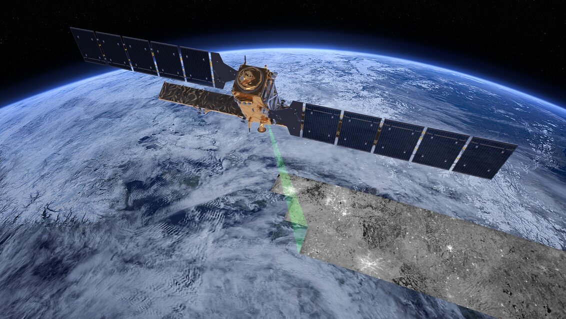
Sentinel-1 satellite; image by ESA/ATG medialab

AGH UST scientists want to use satellite data to warn about sinkholes

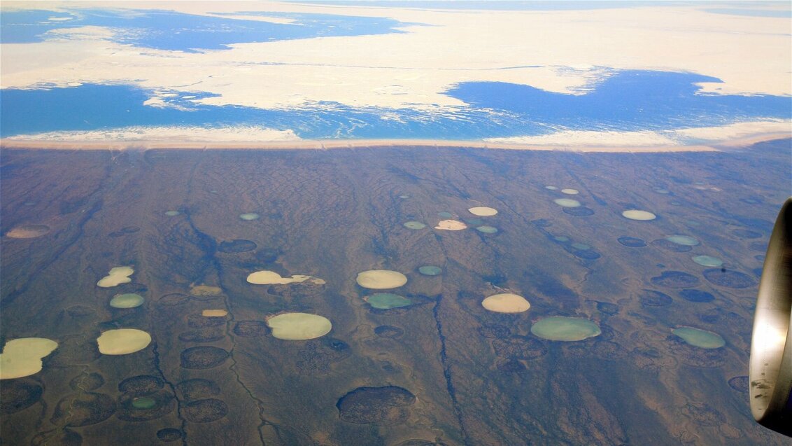
Monitoring sinkholes is a challenge not only to national security services, but also to climatologists. The ones that form in the hard-to-reach arctic regions emit considerable volumes of greenhouse gases into the atmosphere. AGH UST scientists want to use an interferometric synthetic aperture radar (InSAR) to warn people about this phenomenon, before it brings about a direct threat.

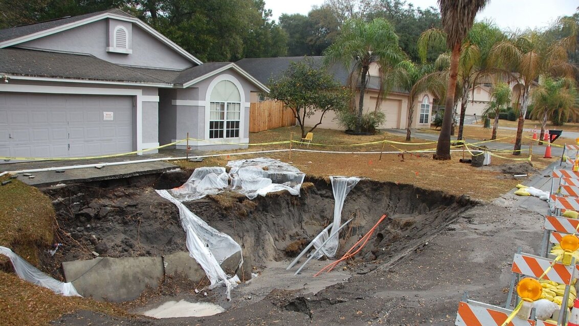
They can swallow people, cars, and even entire buildings. Sinkholes are common in the United States, where, according to local geological services, up to 40% of the country lies within the area prone to their formation. However, the problem affects other regions of the globe as well, including Europe. The chief perpetrator is water that dissolves rocks beneath the surface of the ground (salt, gypsum, limestone, dolomites), which leads to a sudden sinking of the ground. Water penetrating the crust can also work its way inside, creating apertures and empty spaces, which, as a result of gradual erosion, spread towards the surface. The uppermost layer of the ground can then simply collapse under its own weight, revealing a hole underneath that, in some cases, can be quite spectacular in size.

A sinkhole in the suburbs of Tampa, Florida, photo by U.S. Geological Survey

In the foreground, there is a large sinkhole formed in the front yard of a house. In the background, there is a single-storey greyish house with a sloped roof.

Human activity conducive to the formation of sinkholes

The formation of discontinuous deformations on the surface, as the sinkholes are classified by geologists, is a natural phenomenon. However, human activity can be conducive to their more frequent occurrence, for example, intensive irrigation of crops. Sinkholes often appear in areas with extensive mining work when goafs and decommissioned shafts are flooded. This happens because the aforementioned processes disrupt the groundwater system, the pressure of which plays a vital role in keeping the balance in the layers of the crust. Scientists anticipate that in the near future, the trends conducive to the occurrence of such deformations will only intensify – droughts caused by climate changes will increase the need for artificial irrigation of crops, and the mines will be closed in relation to the energy transformation. More and more people will face the threat that sinkholes pose to the infrastructure of cities and towns, as to well as the health and life of residents.

Monitoring of discontinuous deformations of the surface is carried out primarily based on traditional geodetic methods (levelling, GNSS, LIDAR, tacheometry, and georadar methods). Unfortunately, they require on-site measurements, which allow scientists to assess the scale of the phenomenon post factum or might be helpful in determining the likelihood of its future occurrence. However, they do not inform the scientists whether there are any observable changes to the surface directly before the catastrophe. To put it plainly: we know that the bomb has gone off, we don’t know, however, when the fuse had been ignited. ‘Fortunately, we have the interferometric synthetic aperture radar (InSAR) to help us, which, since 2014, has been bringing an entirely new quality to the table of Earth sciences. Thanks to the Sentinel-1 radar mission carried out within the Copernicus programme, we’ve gained open access to data collected even with a six-day frequency. This opened up the possibility of using it in regions affected by the problem of sinkholes. By analysing satellite data, we can scan the surface for signs that precede the formation of a sinkhole, the so-called ”precursors”’, explains Dr Wojciech T. Witkowski from the Faculty of Geo-Data Science, Geodesy, and Environmental Engineering, a member of an international research team called the Land Subsidence and Hazard Mitigation Group.

Dr Wojciech T. Witkowski, photo by the Centre for Communication and Marketing

The photo shows the upper part of a young man’s body. He has blonde hair and wears a beige shirt covered in brown print. The man is smiling and sitting in front of a brown desk with computer monitors and a laptop thereon.

Satellites can capture the formation of discontinuous deformations

The interferometric synthetic aperture radar (InSAR) technique is based on a comparison of two SAR images registered by the satellite during subsequent overflights above the same area. The signal bounced off the Earth has two components. The first is its amplitude (power), which is related to the type of surface that the radar wave bounces off. The second is the distance which the signal travels, expressed by the phase of the wave. The interferometric image of the surface is generated on the basis of the difference between the phases in two subsequent measurements. Those images can be visualised, and they allow scientists to monitor the ground movements with the precision of single milimetres. Considering its accuracy, the technology is used, for example, to monitor the ramifications of earthquakes, volcanic eruptions, or landslides.

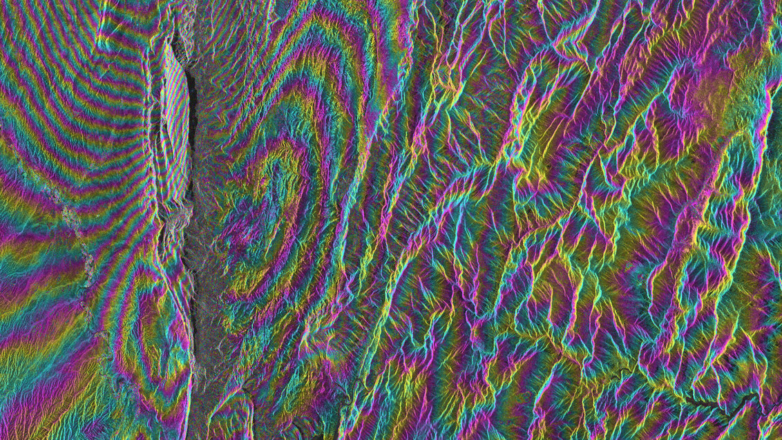
An interferometric image of Iran, depicting ground movements after an earthquake

The picture shows an interferometric image, where individual elements are marked with various shades of red, green, and blue.

Dr Witkowski is a co-author of an article in which scientists have shown the applicability of the InSAR technology to the detection of sinkhole precursors. The researchers have meticulously analysed more than 11 sinkholes in abandoned coal mines, registered between 2003–2010 near the city of Lędziny in the Upper Silesia Province, Poland. Examining archival Envisat satellite images of areas where the sinkholes had occurred has led to some interesting conclusions. ‘In addition to linear motions around the sinkhole, we managed to see an acceleration of the deformation process. This miniscule yet observable acceleration up to - 4,5 mm/year^2 have been registered in a particular area around the sinkholes. We have therefore obtained information expressed in numbers which describes the phenomenon while it forms. This was a sign that we were heading in the right direction’, says the AGH UST employee.

Early warning system for catastrophic phenomena

Currently, Dr Witkowski wants to use the experience he gained in a new project that he leads, which aims to create an early warning system for sinkholes based on the data collected using the InSAR technology. The first step is to collect as much multifarious data as possible. Apart from the area around the Olkusz-Pomorzany mine in the Małopolska Province, the scholars from our university want to analyse regions where the formation of catastrophic phenomena is not related to mining. For instance, they intend to take a closer look at the coast of the Dead Sea, where the sinkholes form as a result of the gradual drop in the water level.

Another area of interest for our scientists is the arctic regions, where the sinkholes have a peculiar genesis. There, global warming causes the ice cap to thaw, resulting in the formation of thermokarsts, that is, shallow hollows filled with water. This not only changes the landscape of the Arctic as we know it, but also worries climatologists. This happens because the process releases considerable quantities of carbon dioxide and methane into the atmosphere, that is, gases that increase the greenhouse effect. ‘The formation of such sinkholes will look entirely differently from the point of view of InSAR observations, that is, the analysis of ground movements. We want to know whether we can capture the formation of the phenomenon with the currently used methods. We hope so, because these regions are difficult to reach. Without remote sensing data, it’s hard to obtain information about the place and scale of an occurrence’, says the project leader.

Bird’s-eye view of the sinkholes (thermokarsts) in the arctic region of Canada, photo by Steve Jurvetson CC BY 2.0

In the foreground, there is a bird’s-eye view of a brown-coloured land dotted with numerous sinkholes. Some of them are filled with azure-coloured water. In the background, there is a fragment of a blue sea, partially covered with white ice floe.

The AGH UST scientists intend to exploit the contacts with geological services of Izrael and Canada, which encounter such problems.

Artificial intelligence to spot what humans miss

The researchers want to supplement the information gathered using the InSAR technology with historical meteorological analyses of particular places, during which data on air temperature, precipitation sum, and soil humidity were collected. They hope to discover correlations that will increase our understanding of the formation process of catastrophic phenomena.

A detailed analysis of such a massive collection of data would be extremely time-consuming, if not impossible, for a single person. That is why our scholars want to employ artificial intelligence to do the work, which will browse through the heaps of data, searching for patterns that accompany the formation of this interesting phenomenon. ‘Our role will be to interpret the information correctly’, Dr Witkowski explains.

The AGH UST scientists hope to be able to implement the patterns determined based on the analysis of archival data for the early warning system for sinkholes they are designing. In such an automatic system, artificial intelligence would search for sinkholes non-stop, browsing a continuous stream of data, and warning against the coming threat.

Our researchers wish that their solution be used to monitor sinkholes in hard-to-reach arctic regions, which may be helpful in the construction of better climate models.

The project titled Novel algorithm of sinkhole precursors detection received funding from the SONATA 17 programme by the National Science Centre.

Stopka